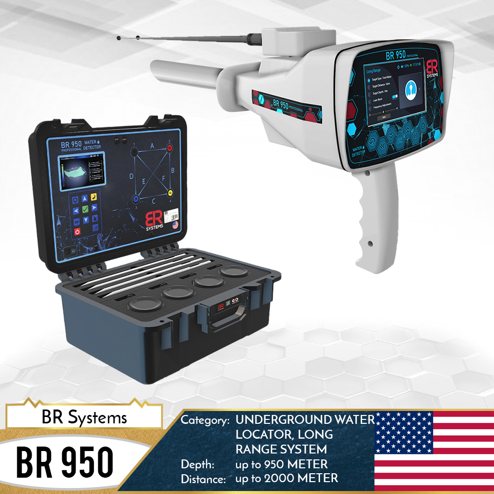
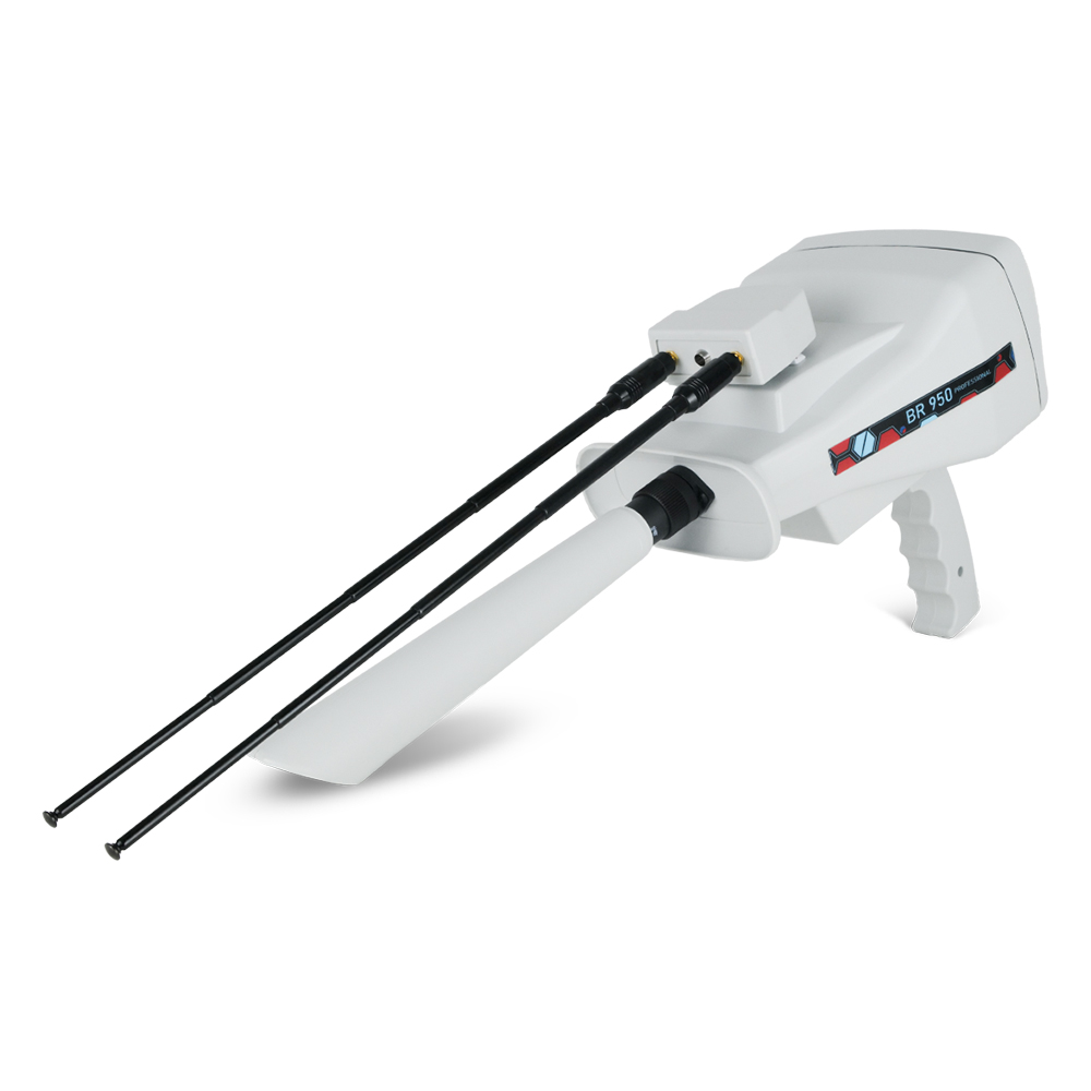
BR 950 PRO its a new generation of multi systems water detector. Br 950 pro has four systems that have been changed the water searching market. With a long process of development, now the BR 950 pro is available as a solution for every drill or farm company.
BR 950 PRO water detector can distinguish between fresh, salt, and mineral water and in the case of the discovery of water immediately shows the water type on the screen if fresh or salty or mineral water, The new underground water detector and waterfinder geophysical device and new SRB technology in the field of groundwater and underground artesian wells revealed.
The BR 950 PRO brings you as user, the most accurate results and will allow you to know the water type and more data about the underground water source. Br 750 pro has the possibility to calculate the water type and depth.
3D Scan system
- This system, developed exclusively by BR Systems, works on a new technology to probe and measure the electrical resistance of the soil (SRT) to determine and discover the places of groundwater. This system has been completely modernized so that it can detect water very accurately with the results shown on the screen and immediately, while showing the type, abundance and depth of the detected water. The discovered location with instant and automatic storage of the detected scans within the device’s memory.
- Maximum search depth: 1200 meters below the surface.
- Distinguishing between the types of detected water: This system automatically shows the quality of the detected water after completing the search process and it appears on the screen (fresh water – mineral water – salt water – highly salinity)
- 3D drawing of the target: This system shows an illustration of the target in three dimensions, and the image of the detected target can be moved in several directions to check its size.
- This device is provided with an external application installed on a tablet computer, through which we can view the search results in full, in addition to a 3D drawing of the targets and store them directly, and the connection between the tablet and the device is done through the Wi-Fi network (called BR 950 Profissional-Password: brsystems) of the device automatically. (Without the need for the Internet), we open the application and review the results.
- Determining the water force automatically on the screen via a special indicator and at a percentage % rate.
- Show digital indicators interacting with all detected signals
- Permanently display interactive audio indicators when running and at the start and end of the search, with the ability to adjust and change them.
- Show the percentage of water salinity discovered through the newly developed PPM scientific analysis technique.
- Determining the depth of the water detected on the screen, and the depth appears automatically on the display screen immediately after completing the search process.
- Changing the frequency of the HZ signal, and this feature allows giving a higher detection efficiency and strength in hard and dry land when the signal is increased, and it can be raised from 30 HZ to 150 HZ.
- Choosing the type of soil to be detected before starting the search.
- Sensitivity adjustment: the sensitivity of the transmitted signal can be raised to increase the electrical signal transmission in the soil, through special values that appear on the screen, which can be increased or decreased according to the need for the density of the water to be detected.
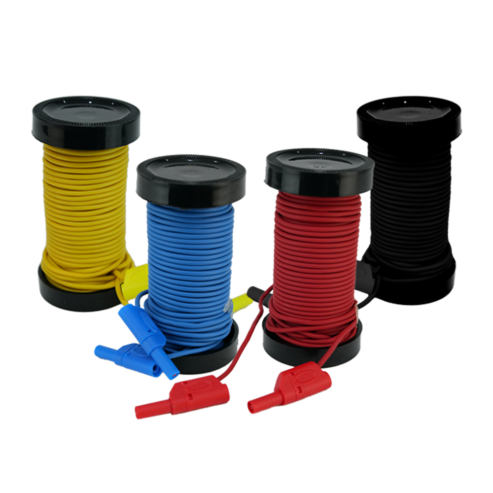
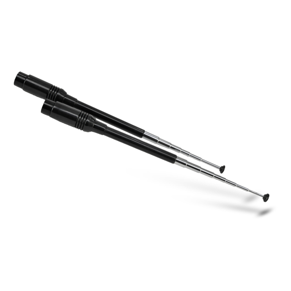
- Determining the distance between the search poles automatically (from 5 m to 50 m), which is a new feature in the world of geophysical devices for water detection, as the distance between the search poles can be determined through the device program before starting the search process to fully correspond with the distance actually used on the ground. This feature ensures that the results are more accurate than the traditional method.
Geophysical system quick scan
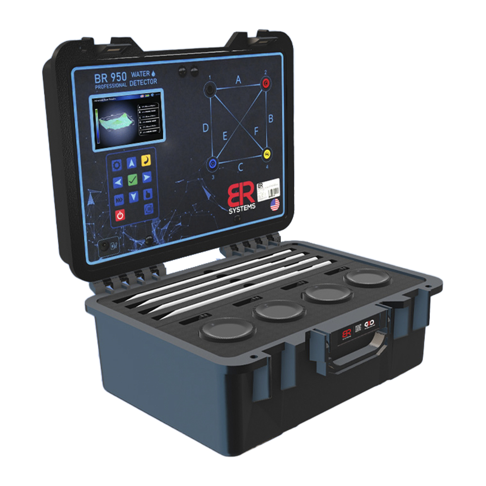
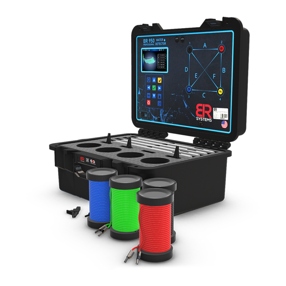
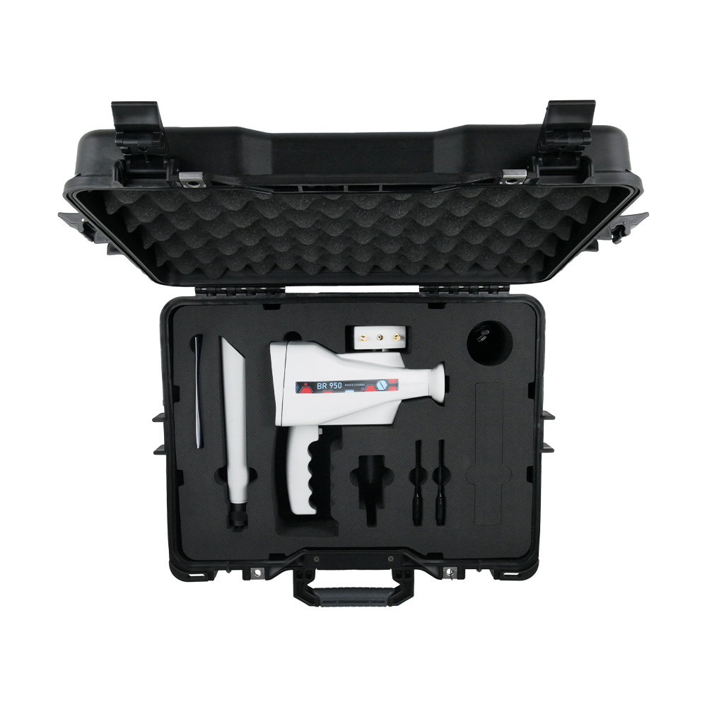
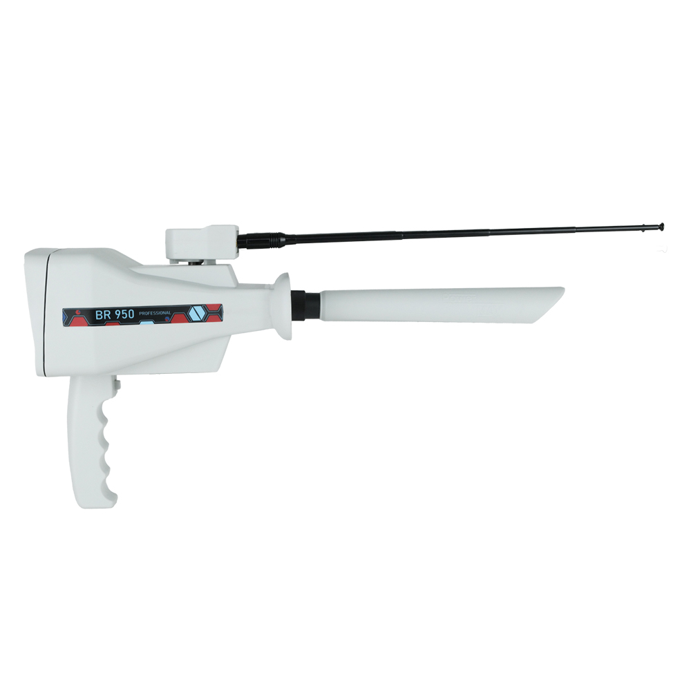
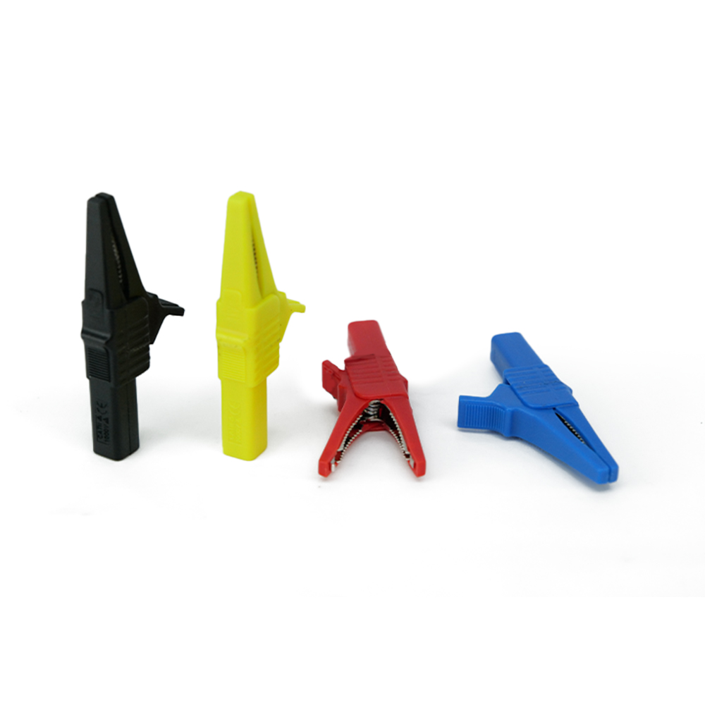
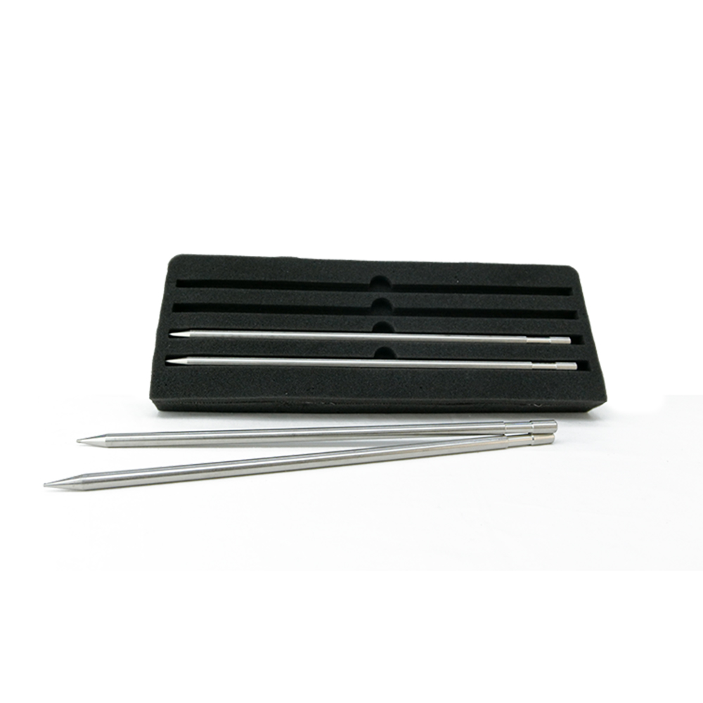
The Br 950 pro unit has 4 probes and cables that connected between the ground and the main unit, those parts will process the data and translate the details on the Lcd screen.
- This system works through the SRT technology developed by BR Systems, that works on probing and measuring the electrical resistances of the soil to locate and discover the locations of water underground.
- The Quick Scan system is characterized by a quick search and scan within a narrow area by planting only two poles in the soil without the need for 4 poles.
- After connecting 2 of the electrodes in the soil, we choose the search line compatible with these electrodes, for example, the search line A, which is compatible with pole 1 and 2, where the device will scan only within this line and show the result on the screen and this feature can be used when needed To make a quick scans in a narrow place, or after using the automatic search system, to limit the location of water within 1 m2.
- Distinguishing between the types of detected water, this system automatically shows the type of the detected water after completing the search process and it appears on the screen (fresh water – mineral water – salt water – highly salinity)
- Maximum search depth: 1200 meters below the surface.
- Determining the water pushing force automatically on the screen via a special indicator and at a percentage rate %.
- Show digital indicators interacting with all detected signals
- Permanently display interactive audio indicators when running and at the start and end of the search, with the ability to adjust and change them.
- Show the percentage of water salinity discovered through the newly developed PPM scientific analysis technique.
- Determining the depth of the water detected on the screen and it appears automatically on the display screen after completing the search process.
Geophysical system automatic search
- The automatic search system in this device has been developed and integrated with modern software and techniques to complete the detection process at high speed and provide detailed automatic results on the screen for the locations of water, its density, depths and salinity.
- Through this system, we can conduct a comprehensive search for a specific area by connecting 4 electrodes in the soil and connecting them with the device through special connection cables.
- This system shows the search results directly on the screen after the completion of the scans process and gives a detailed report on the place that was scans and shows the locations of water with accurate identification and limitation of the target within 1 m2.
- The scanning process in this system is through 6 different scanning lines A – B – C – D – E – F
- Distinguishing between the types of detected water, this system automatically shows the type of the detected water after completing the search process and it appears in written form on the screen (fresh water – mineral water – salty water – highly saline)
- Maximum search depth: 1200 meters below the surface.
- Determining the water force automatically on the screen via a special indicator and at the rate %
- Show digital indicators interacting with all detected signals
- Show interactive audio indicators permanently when running and when searching starts and ends with the ability to adjust and change them.
- Show the percentage of water salinity discovered through the newly developed PPM scientific analysis technique.
- Determining the depth of the water detected on the screen and it appears automatically on the display screen after completing the search process.
| Scan Methods | ADVANCED 3D SCAN – Geophysical search system (Quick Scan) – Geophysical search system (automatic search) |
| Depth | 1200 meters |
| Electrodes Length | 50 meters |
| Frequency | 150 HZ |
| Scan Lines | 6 |
| Targets | Fresh Water – Salty Water – Mineral Water – High Salinity |
| Soil Types | Mineral – sandy – clay – mixed – natural – rocky |
| Supported Techniques | SRT . Soil Electrical Resistivity Measurement Technology PPM . Water Salinity Measuring Technology |
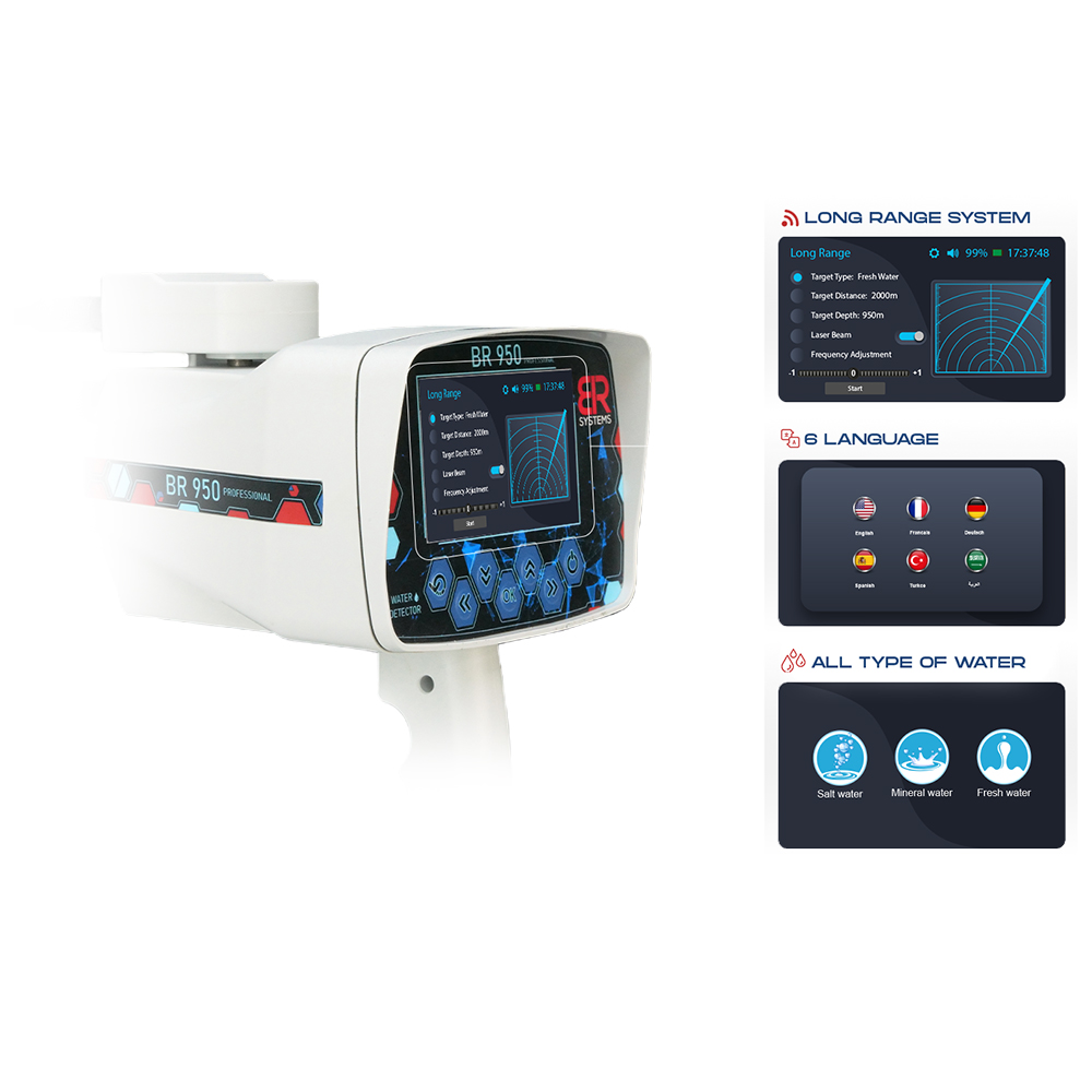
Long range system
- The possibility of determining the quality of the water to be detected before starting the search and restricting other types of water.
- The depth of this system reaches 950 m underground with the ability to determine the maximum depth to be reached.
- The maximum search range is 2000 circular meters with the ability to select on several levels.
- This system is supported by B.U.M . automatic monitoring technology.
- The system supports radar signals on the screen that show that the system is in use and running.
- The system supports audio technology accompanying the radar signals on the screen.
- The laser guidance technology G.L.Y to the system, which in turn shows the user the direction of the target and guides it until reaching the target center.
- The possibility of changing the frequency from -25 Hz to + 25 Hz and this technology is more useful for users who have worked on the device for a longer period.
- List of targets detected by the system: fresh water – mineral water – salt water – all types of water at one time.
- The possibility of controlling the change of the required maximum depth from 25 m up to 950 m based on the user’s desire.
- The possibility of controlling the change of the front range of the detection from 100 m up to 2000 m circular based on the user’s desire.
Reviews