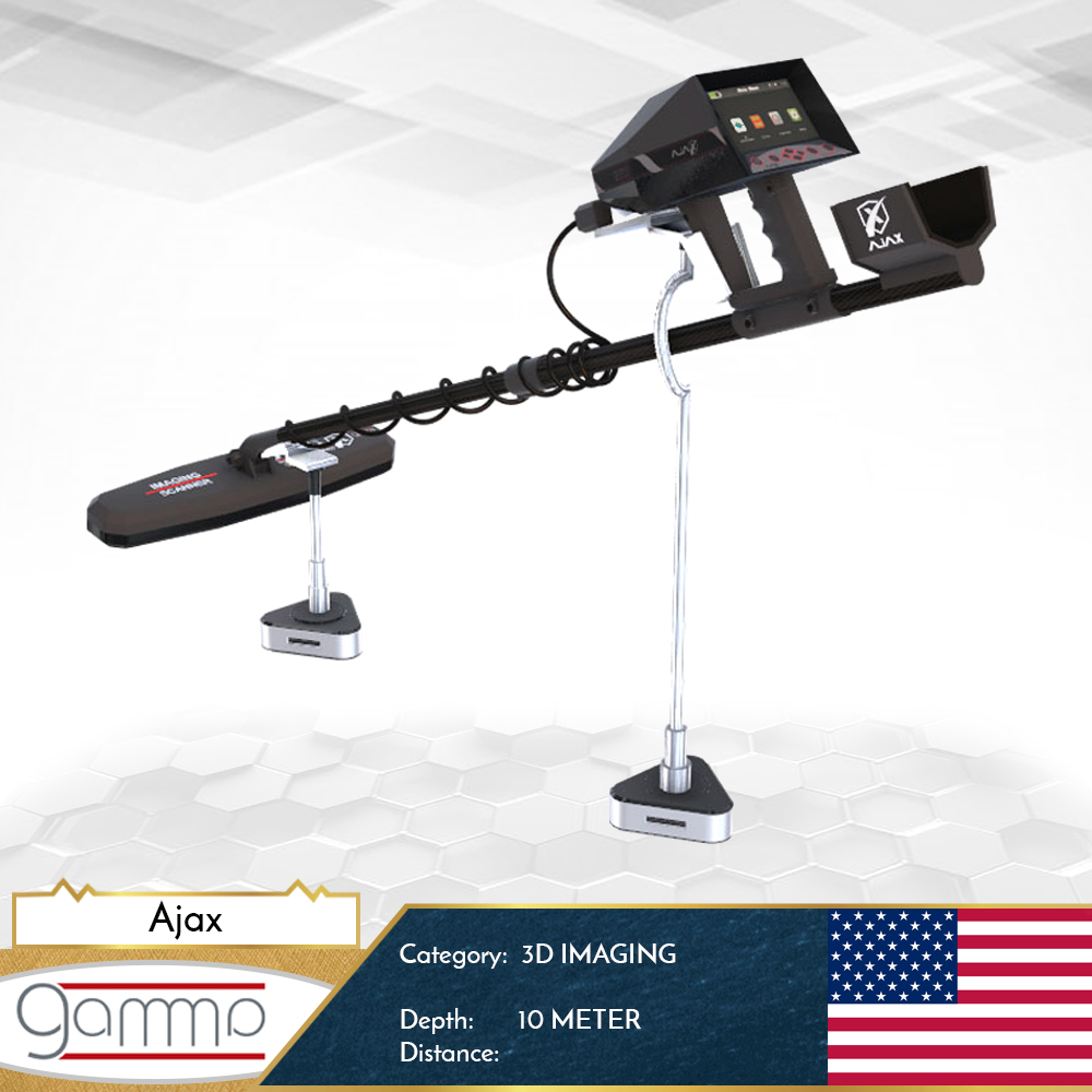
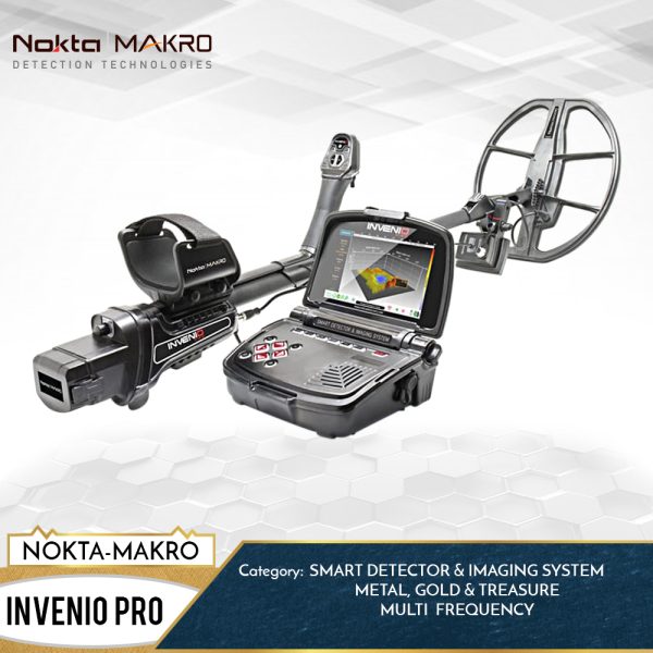
The Gamma is the last 3D edition in the detector innovation, with a Multi functional system device which contains 3 advanced and professional detection systems.
After a long research in the 3D imaging technology, we are gladd to presents the GAMMA new edition, with a high resolution tablet and 3D program which allow you to enjoy from a good time of searching and to detecting the underground surface.
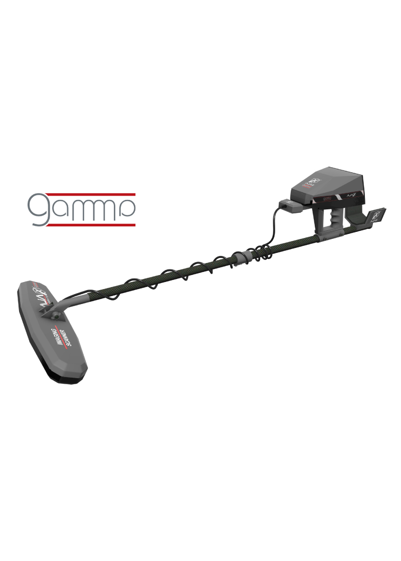
Gamma is the main imaging tool to complete any successful 3D scan.
Languages options: Our products are universally recognized as the best detectors, so we have to provide several languages to support users wherever possible. The device has 8 basic languages: English, French, German, Spanish, Russian, Italian, Turkish and Arabic.
• Gamma has the most advanced detection and scanning systems to detect gold, metals and voids.
• This device works on a new techniques and modern electronic foundations that offer new concepts and dimensions in the world of ground imaging devices.
• A multi-tasking gamma device that allows users to do geological exploration and surveying in its wide ranges, with all tools and applications needed to complete the searches successfully.
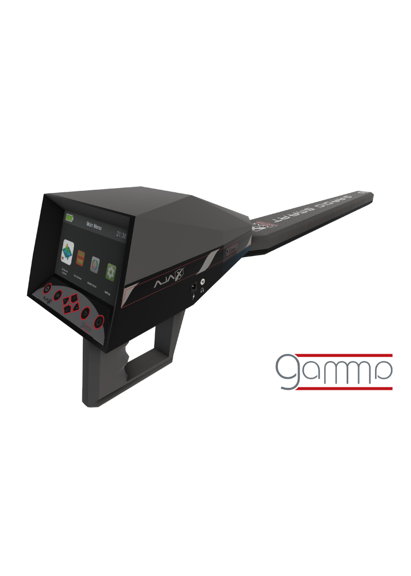
• This device was provided with 5-inch high-resolution soft colorful screen, it allows you to work with advanced professional functions and programs to detect underground targets with full control of the scanning properties and your path exploration journey until you reach the desired target.
• This device can be used through 3 different detection and exploration systems
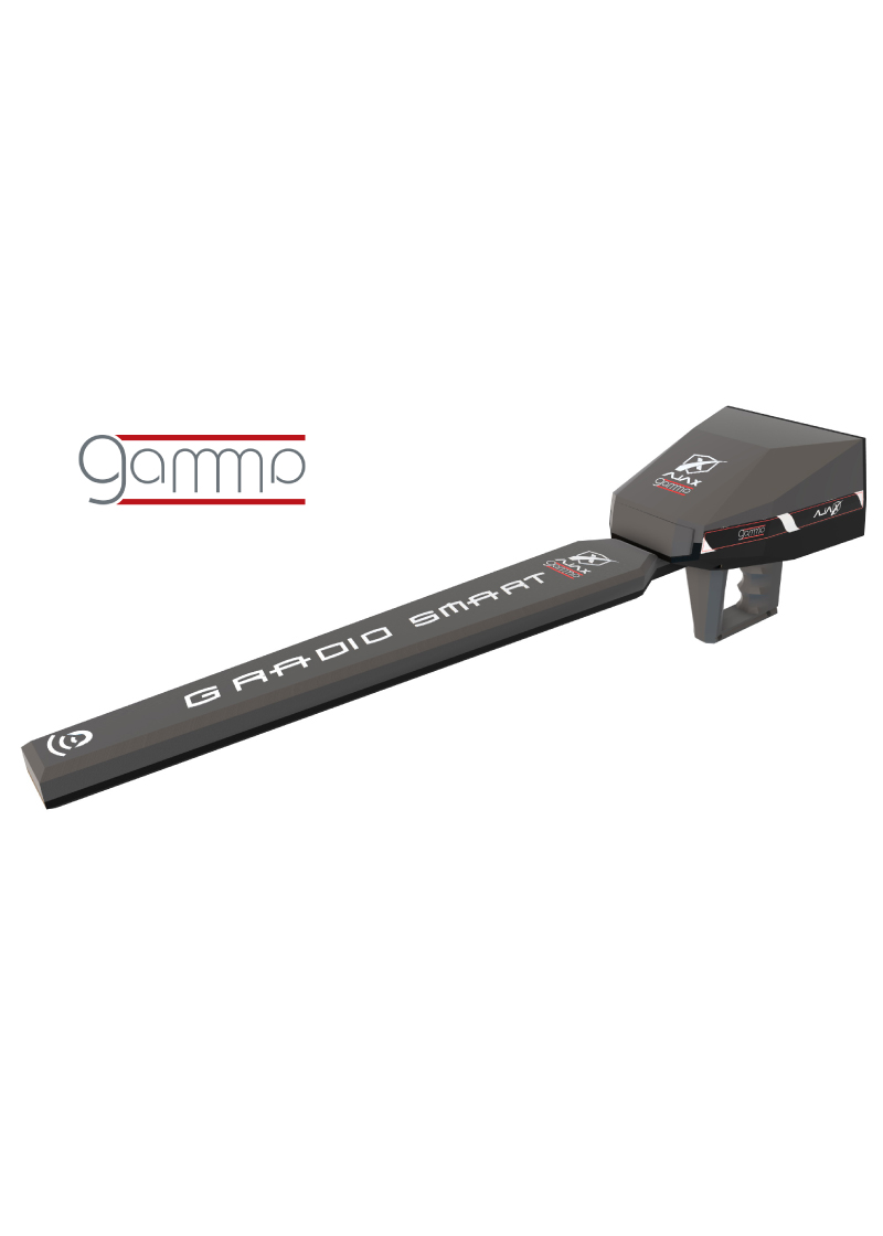
1- Gradiosmart system
2- Live Scan
3- 3D Ground Scanner
Gradio Smart System
• This system usually contains large sizes of equipment and long sensors that aren’t easy to movement and convenient control in the search and immediate results, but we provided you with intelligent control and detection tools that show integrated results on the search interface of this system.
• This system provides accurate measurement of magnetic changes in the soil to detect and identify metallic objects and spaces in addition to distinguish between them.
• The intelligent depth measurement program provides you with a precise measurement of the target’s depth underground regarding to the measurement of the level of reflective changes of the magnetic field.
Colorful screen to display results and settings in 5-inch size, allowing the user to control overall the device settings and to show the results and characteristics of the search.
Maximum Depth – 10 meters, with a depth measurement feature of the target that detected.
Live Scan
• For the first time in the world integrated direct imaging system into the main processing screen of the device without using any external processing screen and programs, this system gives you a direct imaging of all things underground like buried and treasures and clarify its sizes, depths and types.
• You can use two types of scanners that come with the device either through the multi-tasking longitudinal scanner to scan a specific location or through the multi-radar cross-section scanner that works with a high-speed directed power to cover and scan large area in less time.
• Ground balance and calibration, either through automatic calibration of the reference system required for tuning, or through manual calibration, which is determined by the user according to what he deems appropriate for the search area.
Maximum Depth – 30 meters.
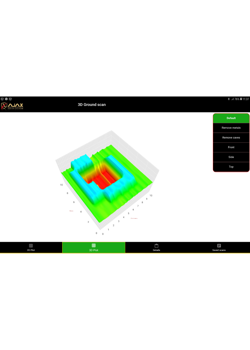
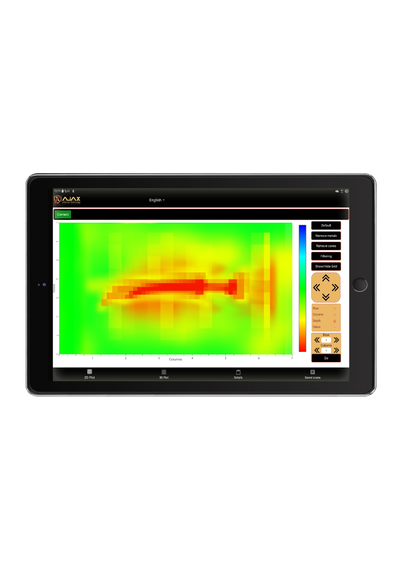
3D Ground Scanner
• According to our survey, we found that every prospector who used the ground imaging systems have encountered many complexities in the use of these devices and its complex programs. However, we have corrected all those complexities and difficulties in our 3D systems. Our system gives you easy and smooth way to use, and anyone can easily interact with.
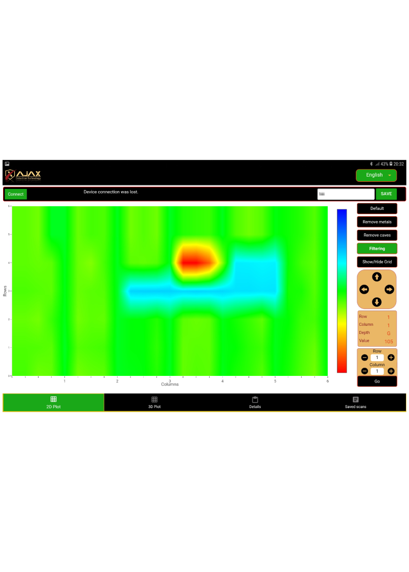
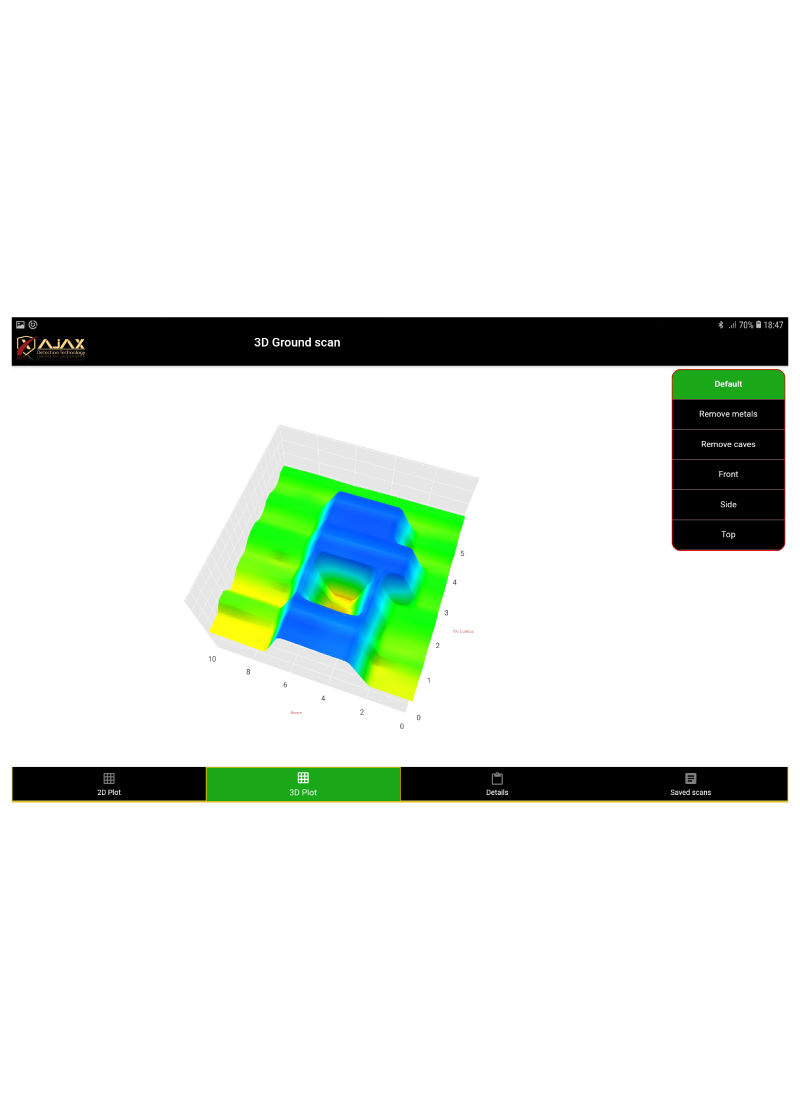
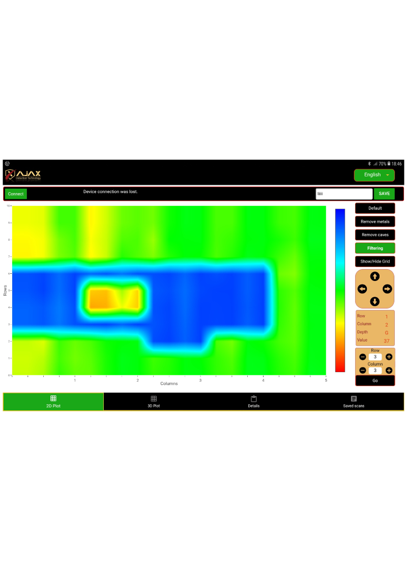
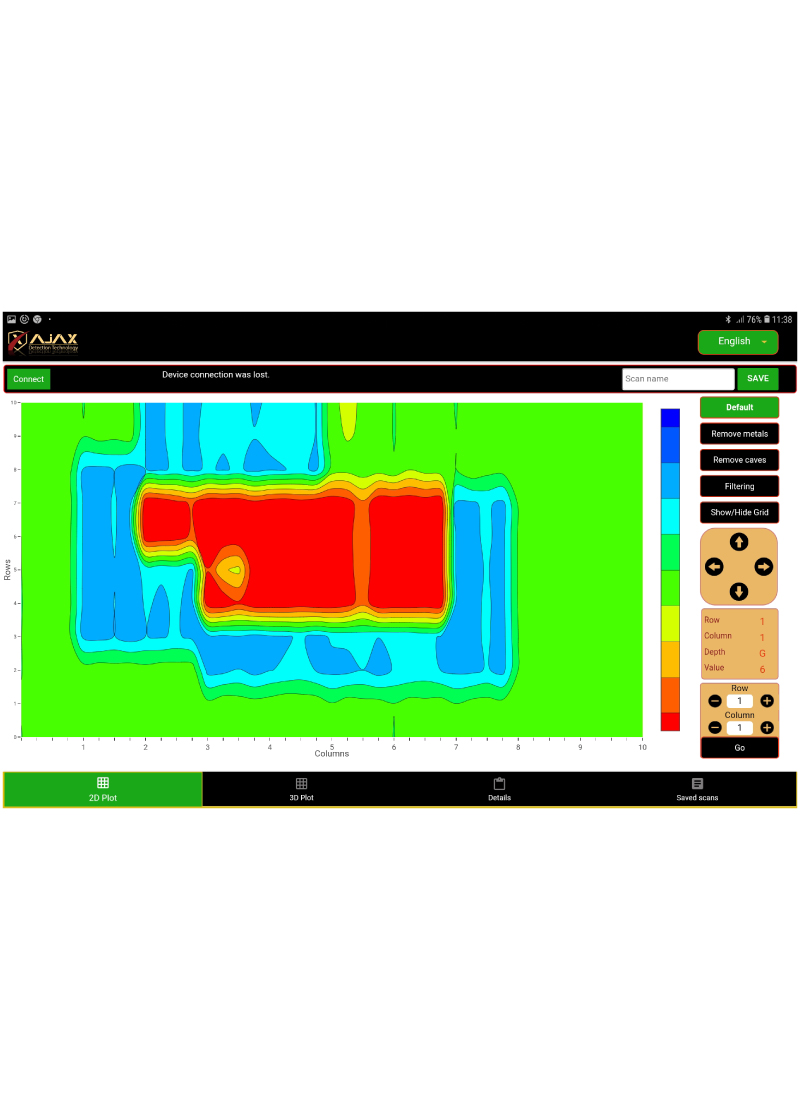
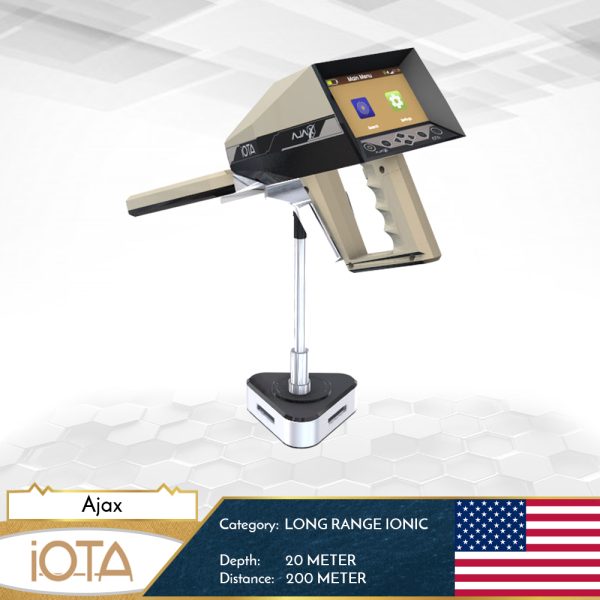
• scanning feature using the Tablet PC to work on AJAX application for analysis.
• Or ground scanning feature from the device screen directly, as desired by the user.
• This system allows you to scan the ground on the screen directly by preparing complete scanning properties, such as control the steps and rows of scanning, scanning method, starting point, searching method (automatic or manual), and then start scanning and show results directly on the screen, in addition to the ability to analyses the scan and find targets places and determine its points.
• The user can also connect the device with the Tablet PC via Bluetooth to work on the Ajax application for analysis, to get more analysis tools and 3D scenes of the targets.
• You can use two types of scanners that come with the device either through the multi-tasking longitudinal scanner to scan a specific location or through the multi-radar cross-section scanner that works with a high-speed directed power to cover and scan large area in less time.
Maximum Depth – 30 meters.
All AJAX products are provided with Two Years Warranty and including the certificate of originality from GERMAN OEM DETECTION.
Reviews