MWF – Ground Scope Live&Ground scan system

3.700,00 (Export Price)

Additional information

Product Description

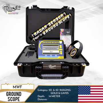
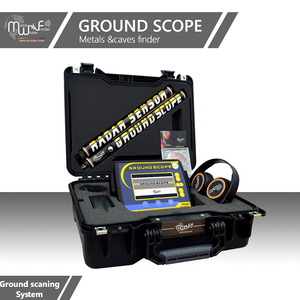
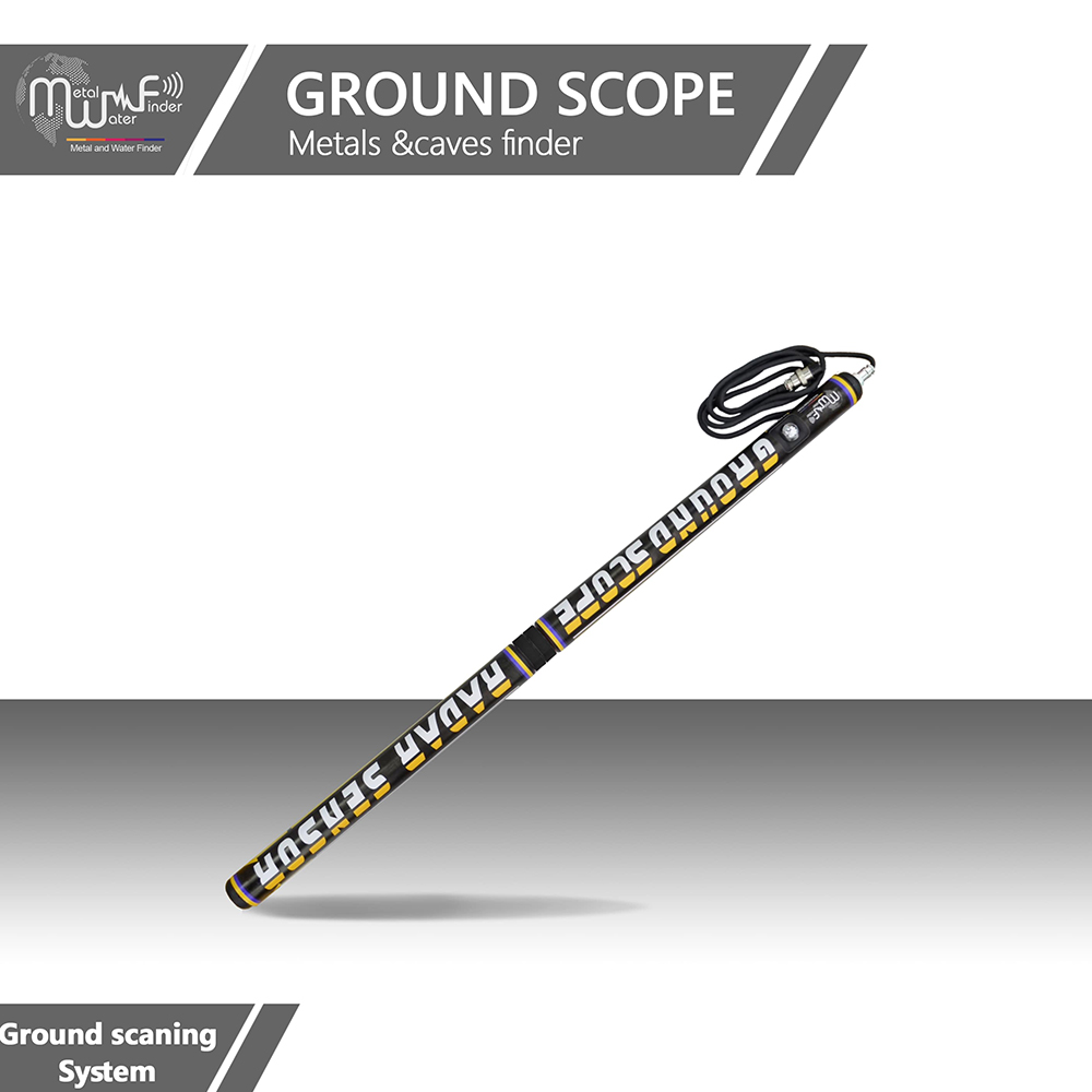
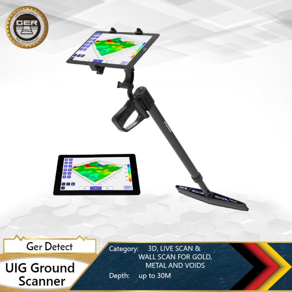
GROUND SCOPE is a leader device to detecting gold, treasures, metal and caves underground to medium depth range up to 14 meters, it operates with the radar imaging system and provides 2D and 3D data for the shape of the detected object underground, and measures the depth of the target.

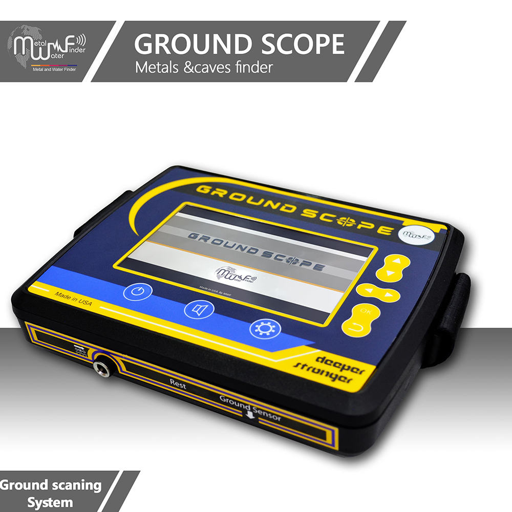
This device is one of the best and latest imaging scanner devices in the world, most sophisticated and accurate in the results, it is very easy to use and does not need external support programs for analysis and imaging, the device will show to you directly results on the screen, in addition, it is offered at a very economical price to give the opportunity for everyone to buying it.

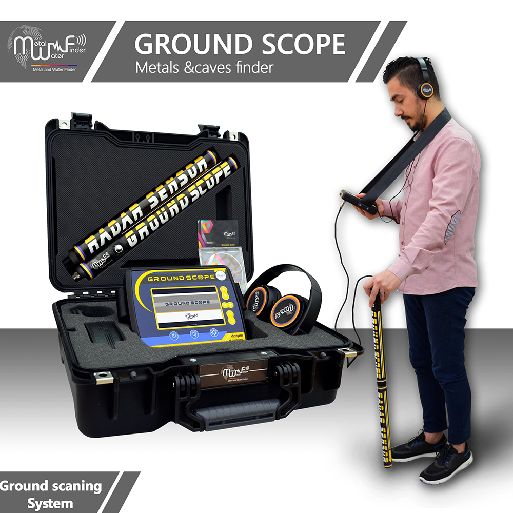
  • Ground Scope works by very sophisticated smart detection technologies and software, It scanning the ground surface to check and search for buried metal or caves through the radar sensor it sends the received values to the main unit, In order for the device in turn to process the data and display on the device screen with 2 and 3D view.
  • Specialized to detects objectives underground, distinguish between them through different colors and numerical values at the same time, and shows the shape of the target underground as well.
  • Provide automatically the depth of all scanned points and shows the depth value of each point directly on the screen.

The device working by two detection and exploration systems:

  • Live Scan system: This system gives the user direct imaging of the ground surface to detect a metal, caves and distinguish between them and monitor their location in real time and will present the reults directly on the 3D screen.

System specifications:

  • This system scans soil layers to identifies their contents and reads levels of electromagnetic fields and radiations to detect the locations of metal, treasures and caves underground.
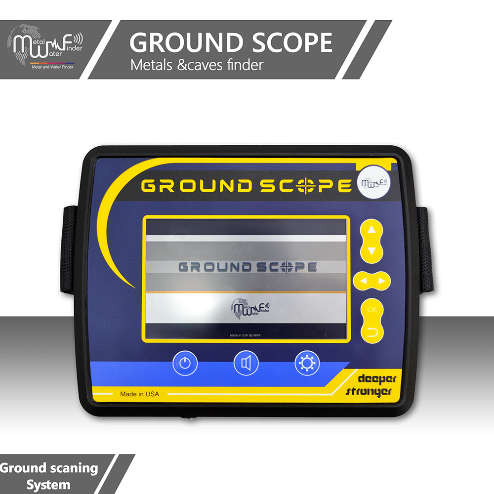
  • A smart interface gives you the user absolute clarity and integrated results about the targets and their locations in real time.
  • Accurate discrimination system between a target.
  • Oscilloscope graphics system to determine the target size and the beginning and end points.
  • Interactive sound indicators associated with graphic data.
  • Ground scan system: This system allows the user to perform a complete survey of the area to be detected and clarify the results of the scanning in the real time on the device screen and determine the value and identity of each point and detection the depth range at the same time, in addition to providing a 2&3 dimensional report of the detected target, with more than one view angle .


System specifications:

  • This system detects and scans the ground layers through a points scanning method, to visualize the ground, clarify the shape and sizes of underground targets.
  • This device gives you immediate live results on the screen and at Real-time.
  • Full control in imaging scanning process
  • Automatic scan mode
  • Manual scan mode
  • Control the dimensions and size of the scan through several options shown on the system screen.
  • Measuring and imaging radar sensors with modern and sophisticated scientific techniques, specializing in the identification and detection of archaeological objects, buried targets, metal and caves, with distinguish between them.
  • Clarify the size and shape of the target and providing a 2D and 3D image report of the scanned area.
  • Software is a very advanced technology level, gives the user easy and quick control of all device settings and systems.
  • Ergonomic design and streamlined shape gives you the power to search and navigate with lightweight and ease of use that have a major role in fast and uncomplicated results.
  • Device’s general settings menu that gives you control of the following:
  • Screen Brightness Control: Gives you comfortable and convenient lighting with 5 different levels of illumination.
  • Volume control: gives you precise and convenient volume control, with 5 different volume levels or silent mode as well.
  • Language Control: Multilingual and gives you control over changing the language of your previously saved device to another language.
  • For the first time globally in the detection and exploration devices exclusively at MWF Group, The device supported with smart operating and detection systems, Smart interfaces, Power conservation system, Smart charging system, Multilanguage and remember device language, save settings, Smart control.
  • The device is characterized by its small size and ease of use, and the dismantling and installation of the radar sensor unit.
  • A control panel with anti-shock pressure buttons gives you quick control of the device and settings.
  • Automatic Tuning System (ATS) Special invention and new, registered in favor of MWF GROUP, this system provides accurate results and proven in all types of soils and terrain, because the system recognizes the soil automatically, grants the search process automatic tuning commensurate with the type of soil and properties of soil , With the abolition of any overlaps radiation resulting by the rocky and mountainous territory effect, which may affect a lot of other detectors, but the this smart system, can sorting and analysis and provide the necessary levels which relates of frequency signal, voltage and wavelength of the signal which gives results free of any errors.

Reviews

Be the first to review “MWF – Ground Scope Live&Ground scan system”

Your email address will not be published.

Select your currency
EUR Euro
1